Integrated Catchment Management
For over 20 years our team have been at the forefront of Integrated Catchment Management. We pride ourselves on implementing innovative and outcome focused ICM.
A comprehensive range of integrated catchment management services
Service and product examples:
Catchment State & Change
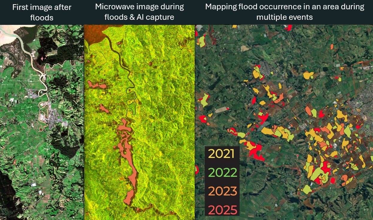
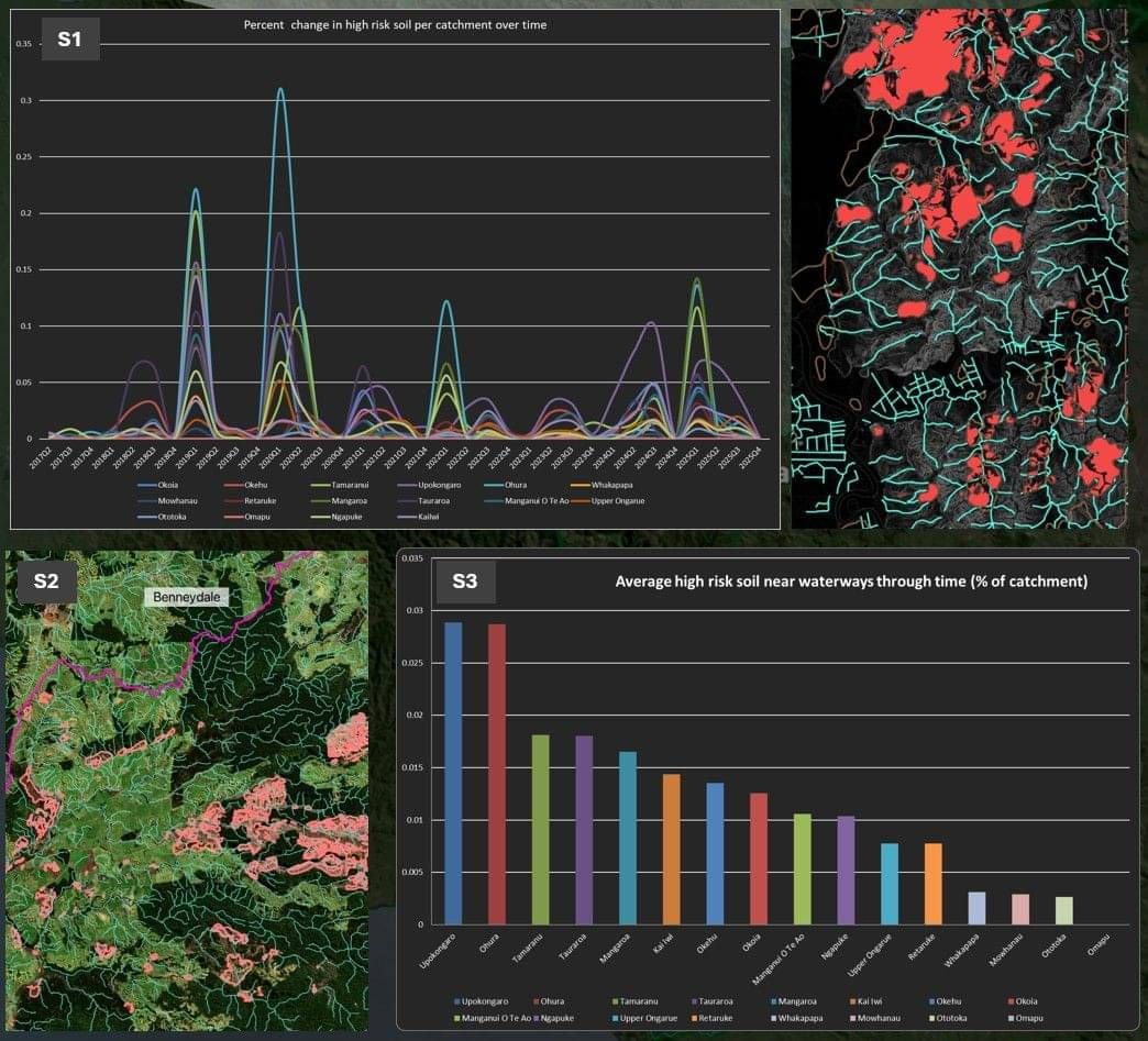
This service provides a fast, reliable way to understand what is happening across your landscape without relying on fragmented data or slow field assessments. Using satellite imagery and AI, it delivers near time insights on flooding, erosion, vegetation change and land use, giving a clear, consistent picture of current conditions and how they are shifting over time. This enables councils, catchment groups and landowners to move quickly from uncertainty to clarity, with robust evidence that supports confident decision making and effective communication with stakeholders.
The value sits in turning complex environmental data into practical action. It highlights priority areas, identifies risks early and supports targeted investment where it will make the biggest difference. Whether responding to extreme weather events, planning catchment interventions or building a long term strategy, it enables a more proactive, coordinated and cost effective approach.
To learn more go to Landscanner.org
Land Scanner is our partner programme designed to help deliver ICM information in an accessible, quick and accurate way.
Innovative landscape prioritisation through LiDAR models and data coupling
The most valuable asset in any landscape-scale approach is understanding.
“If a person seeks to change the world, they should first understand it.” — Joe Abercrombie
For any strategy to be effective, we must be as clear about what we will not do as what we will do. Prioritisation is therefore critical. It ensures effort is directed where it will have the greatest impact, enabling outcomes to be achieved efficiently. Understanding what to do, when, and where across a landscape is often the difference between success and failure.
Our approach is grounded in the Pareto principle, focusing on the 20% of actions that deliver 80% of the impact.
We integrate multiple knowledge systems into our prioritisation. This includes cultural, historical, and community perspectives alongside technical monitoring and remote sensing data. Using a structured logic model, we align these inputs to defined outcomes, enabling actions to be clearly identified, prioritised, and implemented.
This approach ensures our clients can target investment where it matters most, while also supporting robust monitoring and evaluation frameworks to track progress and demonstrate impact.
Field investigation and expert analysis
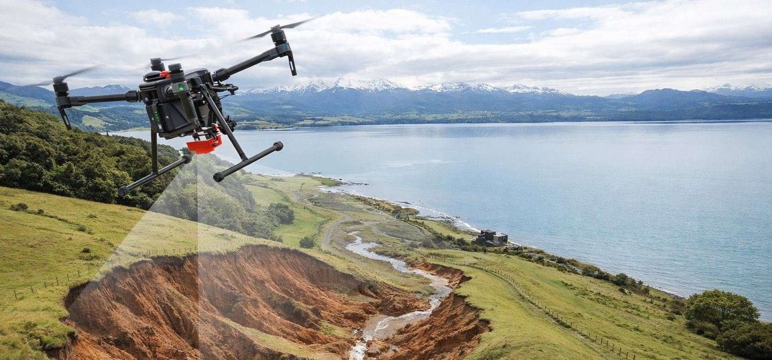
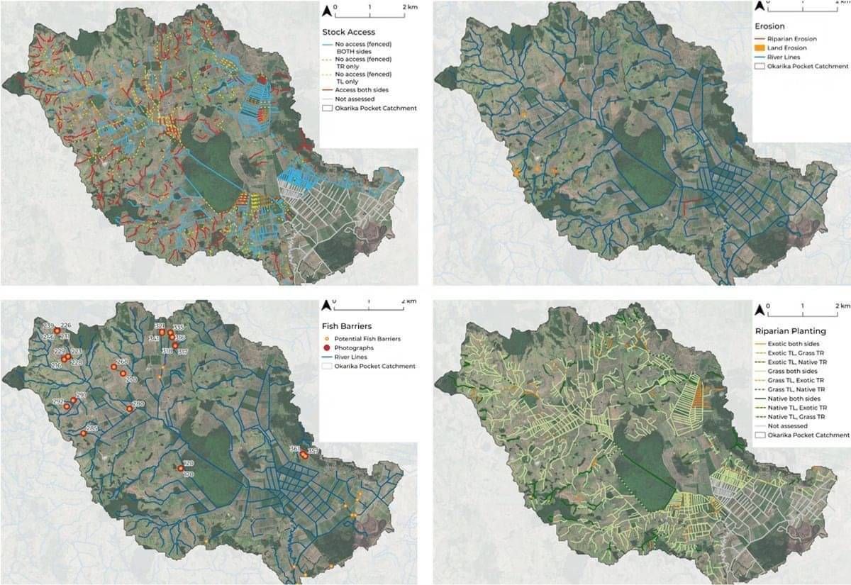
This approach uses mobile GIS platforms and drones to map and analyze absolutely anything in the landscape. Typical applications include mapping the condition of waterways, erosion and biodiversity. It enables analysis to understand the physical state of a catchment and is an excellent baselining and monitoring tool that enables a user to understand the landscape and prioritize actions. For example, this method can enable understanding of the work left to do in a catchment, like waterway fencing. It can help managers cost out restoration or mitigation actions, and effort required to meet objectives through detailed understanding of an areas state. While we now use very modern techniques, this digital mapping approach has been used by Matt since 2010, written up in a regional council paper called "Catchment Condition Survey".
Targeted edge-of-field mitigations through precision placement and practical implementation
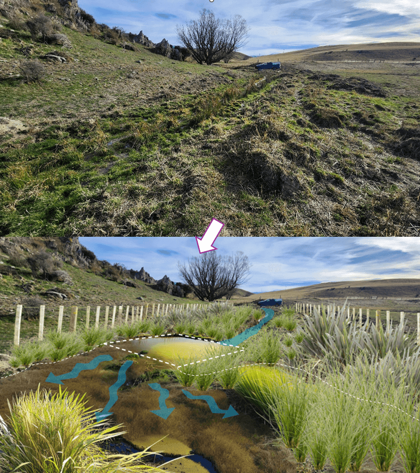
Edge-of-field mitigations play a critical role in reducing sediment, nutrient and contaminant losses before they enter waterways. When designed and placed well, interventions such as bunds, wetlands and sediment traps can deliver significant improvements in water quality and catchment resilience.
The challenge is not whether to use these tools, but where and how to apply them for maximum effect. Poorly located or over-engineered mitigations can be costly and deliver limited benefit.
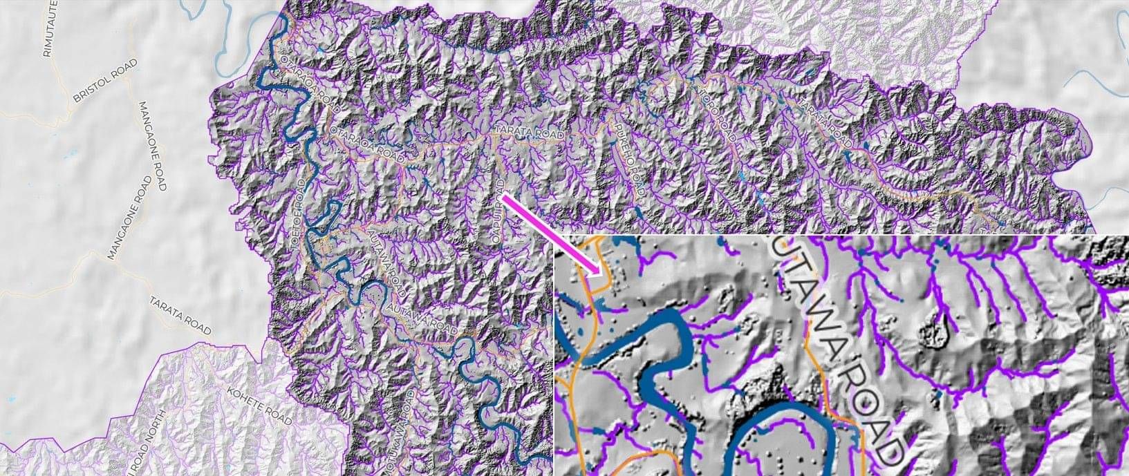
We use high-resolution terrain data, including LiDAR, combined with hydrological analysis and land use information to identify the points in the landscape where interventions will intercept the greatest load. This enables precise placement of mitigations within critical source areas and along key flow pathways, ensuring that each investment delivers measurable outcomes.
Our approach extends beyond identification. We support the full implementation pathway, from concept design through to construction-ready plans, ensuring solutions are practical, buildable and aligned with farm systems and catchment objectives.
By focusing on fit-for-purpose design and targeted placement, we help ensure edge-of-field mitigations are not just installed, but perform as intended, delivering long-term environmental and economic value.
Integrated catchment management plans
Effective catchment management requires more than good intentions. It requires a structured, evidence based approach that connects land, water, people, and policy into a single, coherent system.
When ICMP is done well, it delivers measurable improvements in water quality, reduces risk from extreme weather, strengthens farm and community resilience, and provides a clear pathway to meet regulatory requirements without unnecessary cost or complexity.
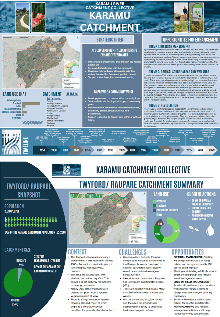
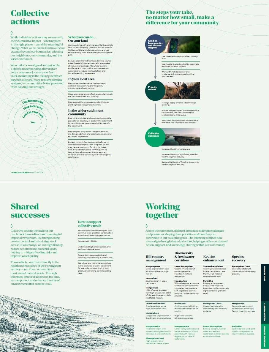
We work with catchment groups, regional councils, and delivery partners to design and implement integrated plans that are practical, prioritised, and grounded in real-world constraints.
Our strength lies in bridging strategy and delivery. We combine technical analysis, spatial tools, and real world experience to ensure plans are not only robust, but actionable.
Our capability includes:
Systems-level planning
We bring together environmental, economic, and social drivers into a single framework, ensuring interventions are aligned and mutually reinforcing rather than fragmented.Advanced spatial analysis and prioritisation
Using GIS, remote sensing, LiDAR, and risk-based modelling, we identify where actions will deliver the greatest return. This includes targeting critical source areas, erosion-prone land, and key flow pathways.Evidence-based decision making
We integrate data on land use, soils, hydrology, and climate risk to build a clear picture of current state, future pressures, and intervention opportunities.Practical action planning
We translate strategy into clear, staged actions with defined costs, sequencing, and delivery pathways, ensuring plans can move quickly into implementation.Funding and partnership alignment
We identify funding opportunities and help align stakeholders, agencies, and landowners to support coordinated delivery at scale.Implementation support and programme design
We design delivery models that work in practice, including governance structures, roles, and performance frameworks.Monitoring, reporting, and adaptive management
We establish systems to track progress, demonstrate impact, and adapt over time, including the use of near real-time data where appropriate.Clear and compelling communication
We develop materials that translate complexity into simple, engaging messages that support uptake by landowners, communities, and decision-makers.
Our approach
We have developed a structured process that moves from understanding to action:
Define outcomes with the community and stakeholders
Build a clear evidence base of current state, risks, and opportunities
Prioritise interventions based on impact and feasibility
Develop costed, staged action plans
Support implementation through tools, governance, and partnerships
Monitor outcomes and refine over time
What sets us apart
We focus on making plans work. Too often, catchment plans are technically sound but sit on the shelf. Our work is designed to be used, with a clear line of sight from analysis through to action and measurable outcomes.