Adaptation & Resilience
We help communities, councils and landowners respond to climate risk with practical, evidence-based adaptation and resilience planning. From strategy and infrastructure pathways through to catchment planning and long term extreme weather resilience.
Practical adaptation for changing landscapes and communities
We help agencies, councils and landowners respond to climate risk with clear, practical action.
Adaptation is not just about understanding risk. It is about making good decisions early, focusing effort where it matters most, and building resilience over time. We work across strategy, planning and on-the-ground delivery to turn uncertainty into confident next steps.
Our work spans infrastructure, catchments, flood resilience, erosion control and community-led action. We combine spatial analysis, local knowledge and implementation planning to ensure practical and achievable adaptation and resilience planning.
We Can Help With Adaptation and Resilience Planning
EIS has a range of experience and approaches that support the wide rage of needs in adaptation planning:
We live in a changing world
Adaptation is essential to ensure our communities, infrastructure and landscapes remain viable in the face of increasing climate and environmental change. As risks such as flooding, erosion and extreme weather intensify, the cost of inaction grows rapidly. Effective adaptation allows us to anticipate change, reduce long-term impacts and make smarter investment decisions now, rather than reacting later.
Adaptation strategy and planning
We support organisations to understand risk, clarify choices and develop practical adaptation pathways. This includes hazard-informed planning, infrastructure resilience, option analysis and implementation planning that supports decisions over time, not one-off reports.
Spatial analysis and prioritisation
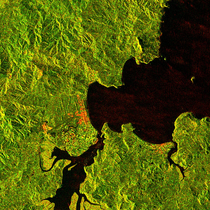
We use remote sensing, mapping, LiDAR and GIS to identify erosion risk, flood pathways and priority intervention areas. This ensures investment is targeted to the right places to maximise impact.
Defining roles, responsibilities and governance
Adaptation often stalls when roles are unclear. We help define who does what, how decisions are made and how funding and delivery can work in practice, bringing structure to complex multi-agency environments.
Stabilization of vulnerable catchments
We work with landowners and catchment groups to reduce erosion and sediment loss through targeted, practical approaches. This includes identifying high-risk land, selecting fit-for-purpose interventions and building confidence through demonstration and evidence.
Catchment & community
resilience
We develop catchment-based strategies that connect land, water, biodiversity and community outcomes. Our work helps groups focus effort where it will make the biggest difference and align action across the landscape.
Cyclone recovery and resilience building
We support communities to move from recovery to long-term resilience. This includes identifying priority risks, shaping programmes, and designing practical actions that reduce future flood, erosion and infrastructure impacts.
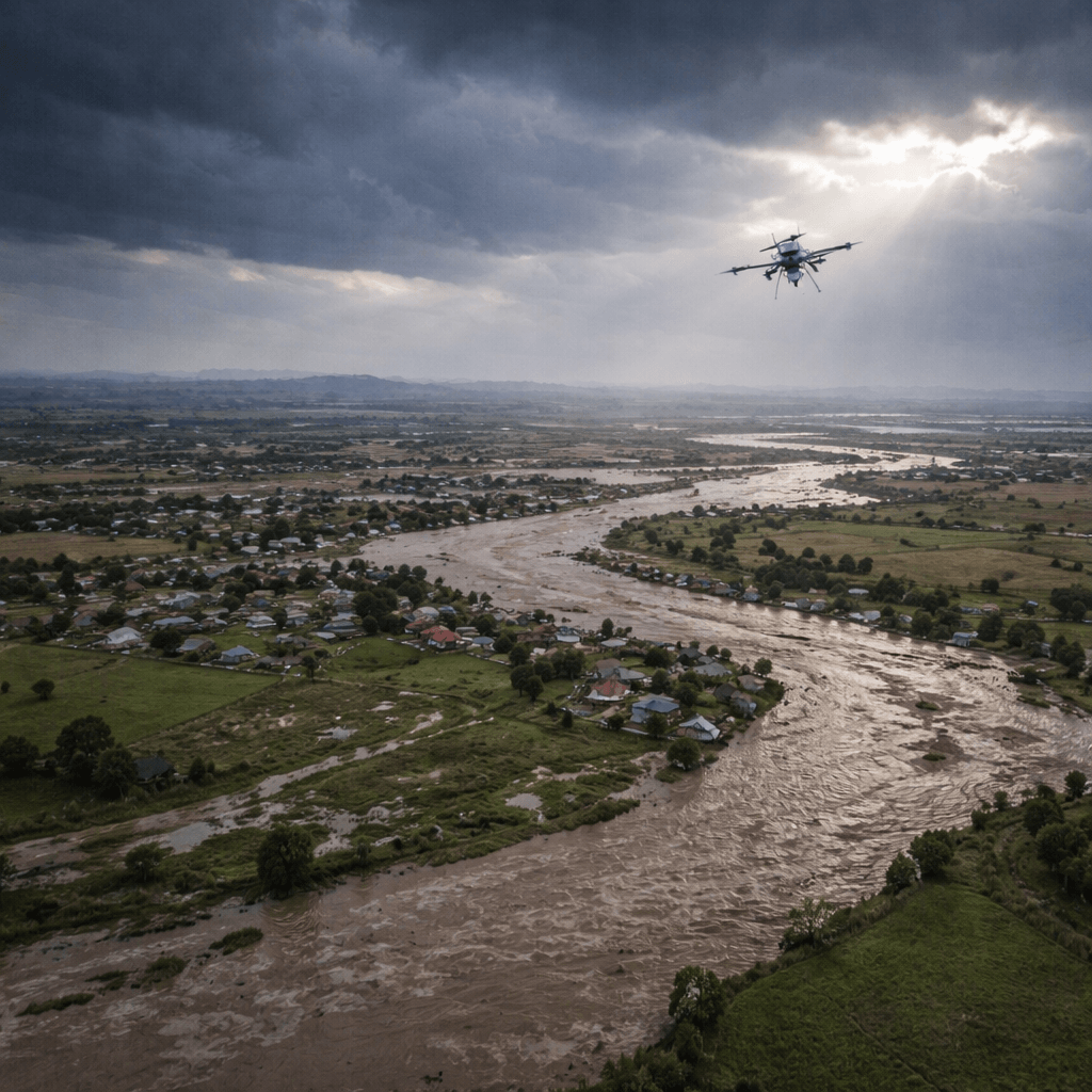
Extreme event monitoring and rapid assessment
We provide near real-time understanding of what has changed following storms, floods and other extreme events.
Using drones, satellite imagery and remote sensing, we rapidly capture and analyse erosion, sediment movement, flooding extent and infrastructure impacts. This allows clients to move quickly from observation to decision-making, whether that is targeting repairs, prioritising investment, or communicating impacts to stakeholders.
Examples of Our Work
Our approach is grounded in building a clear understanding of the system that is being worked in, using data, mapping and engagement to define the landscape, risks, infrastructure as well as economic, community and legislative context.
Adaptation planning for infrastructure and communities
EIS provided adaptation planning for Auckland Council, alongside Haskoning New Zealand. This project focused on opportunities to incorporate adaptation into infrastructure decision making, creating a process to enable adaptation thinking throughout planning that aligns infrastructure and community decision-making, with clear pathways for action in hazard-prone areas.
Thames protection and resilience
We led work to clarify climate adaptation roles and responsibilities for Thames and Tararū, where flood, coastal and stormwater risks overlap. This involved reviewing the current state of infrastructure and hazard management, analysing legislative and funding frameworks, and identifying options for governance and delivery. The outcome was a clear, integrated view of how councils and stakeholders can work together to plan, fund and implement long-term resilience solutions.
Cyclone-impacted landscapes
Following Cyclones Gabrielle and Hale we worked across multiple different landscapes and multiple projects in Hawkes Bay. We worked with authorities, communities and catchment groups to develop practical, community-led action plans that respond to both immediate damage and long-term resilience needs. This included catchment-scale risk assessment, targeted actions and combined science, local knowledge and community priorities to create long term resilience plans.